
Thermal Satellite Image Analysis
Client: Constellr
When: 2024
Summary: Development of algorithms for Land Surface Temperature image analysis
Techniques: Computer Vision, statistics, machine learning
Context:
Constellr provides global land surface temperature data for sustainable agriculture and resource monitoring. Utilizing thermal satellite technology, they offer precise, daily insights into plant health and water stress. This enables farmers and land managers to optimize irrigation, improve yields, and reduce resource consumption. Constellr's data supports proactive decision-making, aiming to enhance food security and environmental sustainability through advanced thermal imaging.Project:
Deeper Analytics played a crucial role in enhancing Constellr's land surface temperature analysis by addressing critical data integration challenges. We developed sophisticated algorithms to harmonize the varying spatial resolutions of satellite data from sources like Landsat, MODIS, and Sentinel. This upsampling ensured a unified, high-resolution dataset. Furthermore, we implemented techniques to align temporal resolutions, enabling seamless comparison and combination of images captured at different timestamps. Finally, another algorithm effectively filled data gaps caused by cloud cover by combining multiple data sources with their respective spatio-temporal resolution , ensuring continuous and comprehensive coverage. These contributions significantly improved the accuracy and reliability of Constellr's thermal data, empowering users with more precise insights.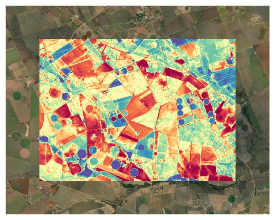
Share this page:
© Copyright Deeper Analytics, since 2018