Tag archives: geodata

RSS feed of geodata

Last update on .

Reverse Image Search used to find similar road markings in large aerial pictures

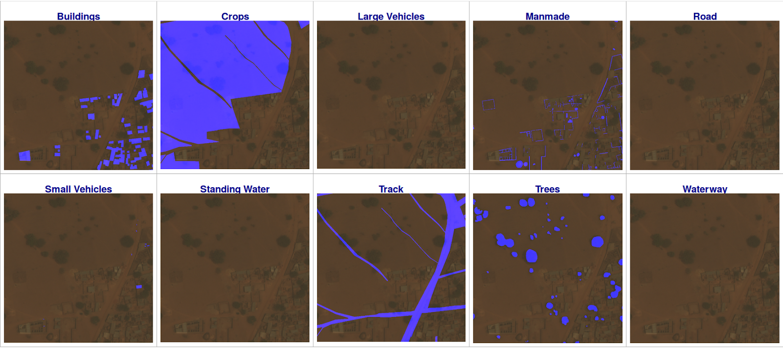
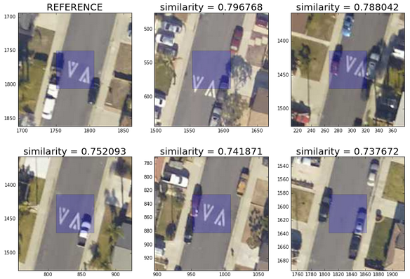
In this blog post, we will see how we can use reverse image search based on (unsupervised) convolutional neural networks to make the analysis of satellite/aerial pictures both more efficient and simpler. After reading this post, you will be able to find similar objects in a large aerial/satellite images and from there develop your own GIS statistical applications (i.e. to count all white cars in your neighborhood, identify specific road markings or kind of trees, etc. ).


Last update on .

Scalable Geospatial data analysis with Geotrellis, Spark, Sparkling-Water and, the Spark-Notebook

Note: This blog post was initially written for the blog of Kensu.io, You can either read it here, or continue your reading on its original publication page.

This blog shows how to perform scalable geospatial data analysis using Geotrellis, Apache Spark, Sparkling-Water and the Spark-Notebook.

As a benchmark for this blog, we use ...


Last update on .

Identifying new shop implantation thanks to geo-data analysis

In this blog, we will see how we can perform geospatial data analysis in order to identify new business opportunities.  For this showcase, we will focus on the retail sector and more precisely on the supermarket leading brands in Belgium: Colruyt, Delhaize, Carrefour, and Lidl.  We analyzed the location of supermarkets in Brussels, computed the average time travel to the closest supermarket for Brussels neighborhood and see how these four major brands are sharing their market zone among Brussels neighborhood accordingly.  We are reusing the techniques detailed in the Dynamic Web scrapping blog post.  The techniques described in this post can be useful for all sorts of B2C companies involved in the retail sector, where competition is generally strong and shop implantation matters. ...