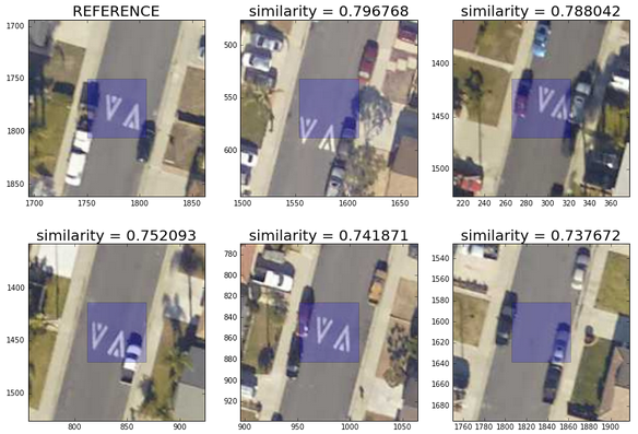
In this blog post, we will see how we can use reverse image search based on (unsupervised) convolutional neural networks to make the analysis of satellite/aerial pictures both more efficient and simpler. After reading this post, you will be able to find similar objects in a large aerial/satellite images and from there develop your own GIS statistical applications (i.e. to count all white cars in your neighborhood, identify specific road markings or kind of trees, etc. ).
Reverse Image Search in Aerial and Satellite pictures
Written by on in Business Case, Deep learning, GeoSpatial.
Last update on .
